
Our sustainable Agriculture team supported Living Farm Agri-Tech Demo day on Friday March 31st. Alice Butler, a DPIRD research Scientist shared her findings from an on-farm soil acidity and nutrient management project that was in collaboration with Central Wheatbelt Growers. As we know, soil acidity if one of the major challenges that can limit crop yields in the Wheatbelt. Lime is essential to neutralise acidity, which can improve soil structure, nutrient availability, and water uptake. Moreover, lime can boost microbial activity, reduce aluminium toxicity, and enhance root growth.
The research has analysed and used modelling to compare soil acidity amelioration strategies used across the Wheatbelt. The results Alice shares help to give farmers an insight into how to make better lime management decisions for long term benefits down the whole soil profile. We often see regular liming applications, but some of the results Alice presented suggests that a large application that is incorporated correctly, although costly, can have long outstanding results. Lime that is not incorporated only reaches the topsoil and does not address sub-soil acidity. It can also take years for the benefits to be fully realised. This leads to poor root growth as roots reach acidic bands deeper in the profile, which often have poor nutrient availability. Incorporating lime can be a large upfront cost due to labour, machinery and increased lime required because of the dilution effect, but Alice suggests if done correctly, can save you in the long term. Alice also highlighted the role precision agriculture; specifically variable rate applications can play in liming management. Farmers are encouraged to use soil results to apply the precise amount of lime in specific areas across a single paddock.
Frank D’Emden added to Alice's liming discussion, on how Geophysical sensors can play a crucial role in precision liming applications. Electromagnetic and GAMMA sensors can provide valuable information about soil properties, such as electrical conductivity and soil moisture, which can be interpreted to create variable rate lime application maps. These maps can be used to apply lime at varying rates across a field, based on the specific needs of each area. It is advised that these maps are ground truthed with soils samples across the sites as the results are not always completely accurate.
Frank also demonstrated some interesting results from his Living Farm automated weather station project, where he compared a number of different automatic weather stations installed across York, Beverly, Quairading and Meckering in 2022. The results suggest that there is a large variation in BoM and DPIRD weather stations and an increased need for more weather stations across the Wheatbelt, as weather variability is common. Frank highlights opportunities for farmers to increase their access to real-time weather data such as temperature, humidity, and rainfall which can help them make informed decisions about spraying and safe burning times.
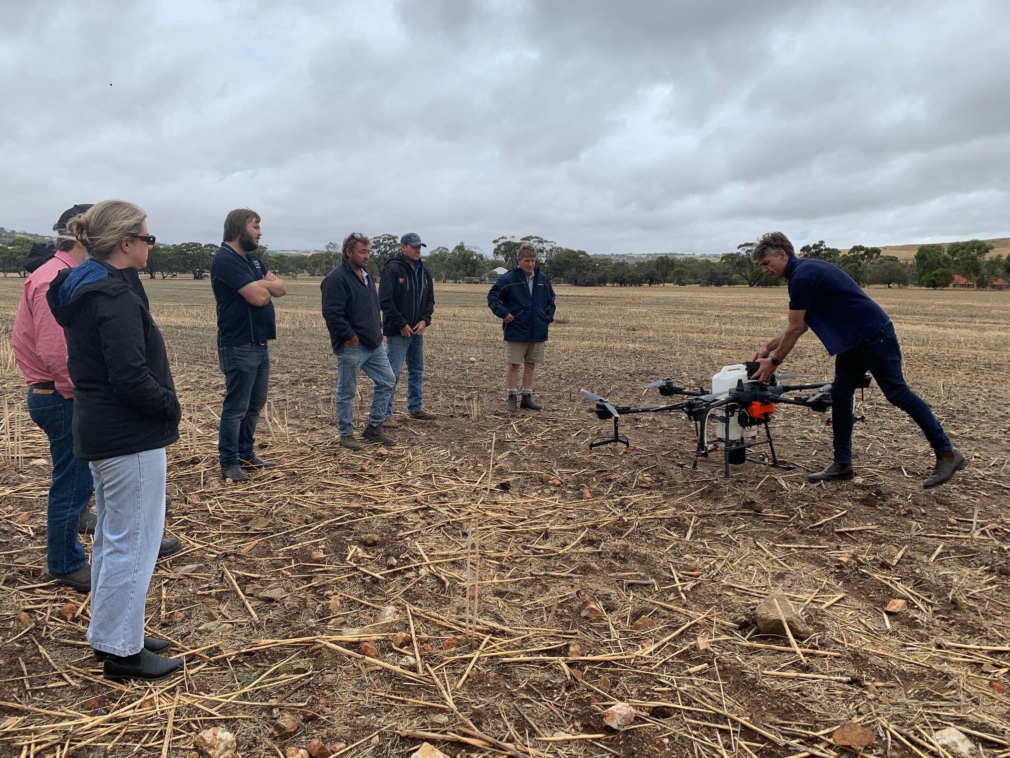
The main highlight for some of the attendees was the live 20L spray drone demo as part of the results from the Living Farm trials that use drones to control weeds and re-establish pastures and native vegetation on rocky outcrops. Rocky outcrops are a major challenge for farmers in the Wheatbelt region as they reduce the amount of arable / accessible land and are home to many weeds. Spray drones and spreaders can be used to apply herbicides and other chemicals to rocky areas that are difficult to access with traditional machinery. They can also be used to spread seed and fertiliser. Additionally, using these technologies can reduce labour costs and improve safety by reducing the need for manual application of chemicals. There are benefits and disadvantages for using spray drones, and it is expected that the market for agricultural spray drones and machines to grow, making them more affordable and accessible to farmers.